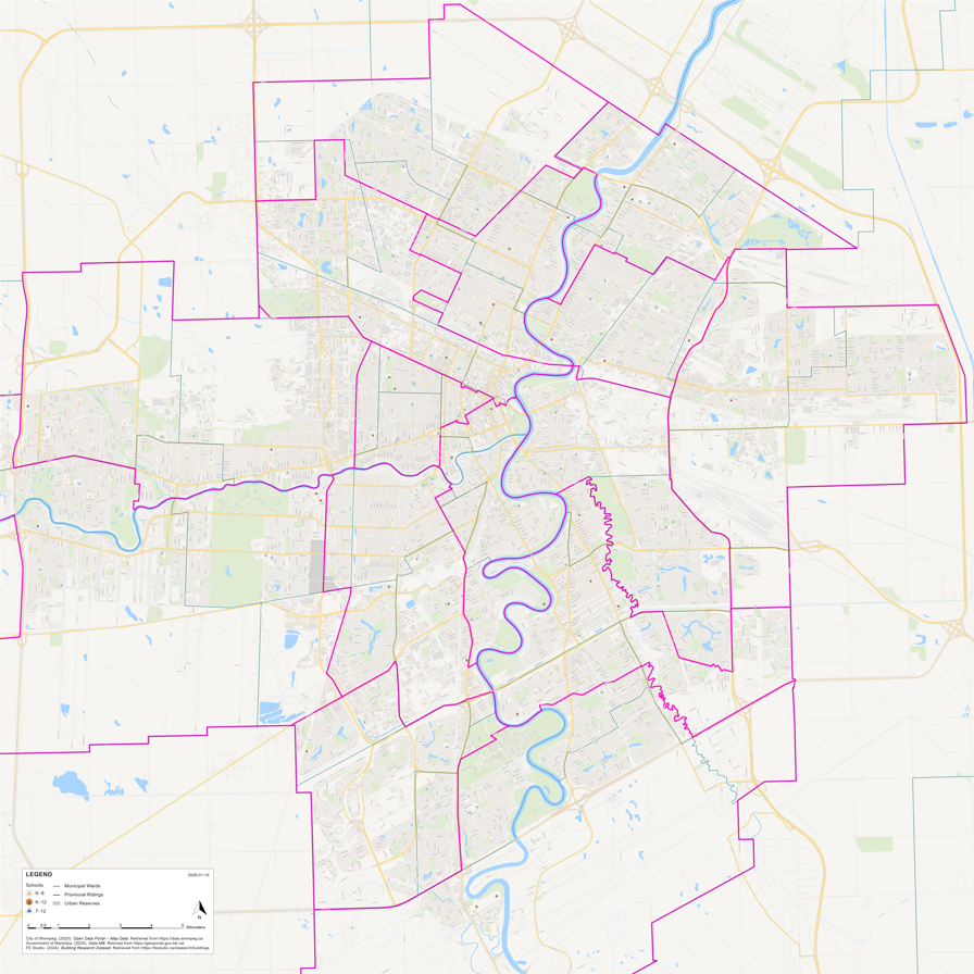
City of Winnipeg Vector Base Map, 2025-2026
Created a six-foot by six-foot vector-base map of the City of Winnipeg for a community research project, designed to be laminated and annotated. I developed the base map from scratch in ArcGIS Pro, cleaning and preparing data from the City of Winnipeg Open Data and Future Elements Studio. This map visualizes federal ridings, municipal wards, street names, and urban reserves clearly at a large scale.